
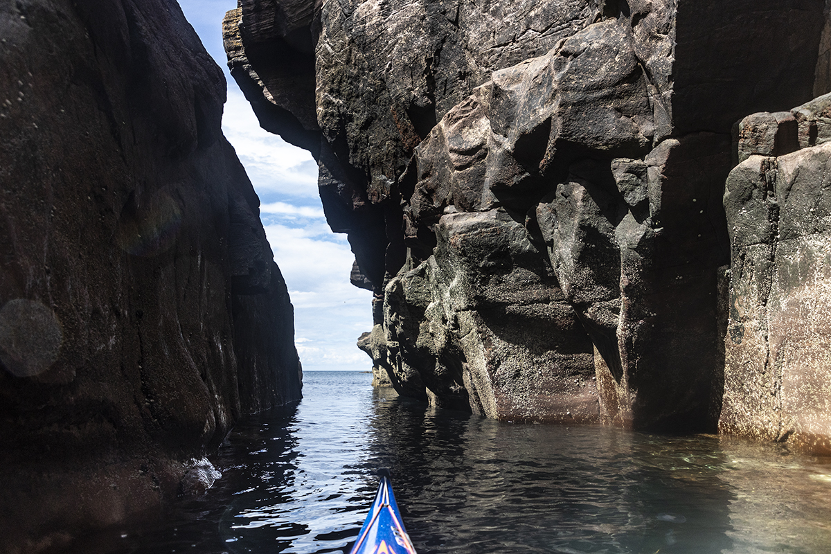
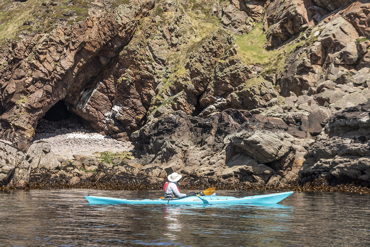
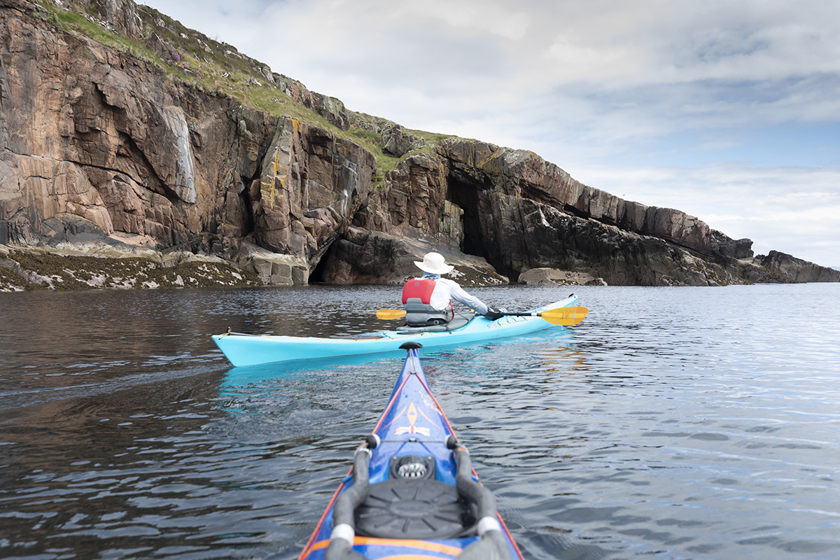
Features of the Summer Isles
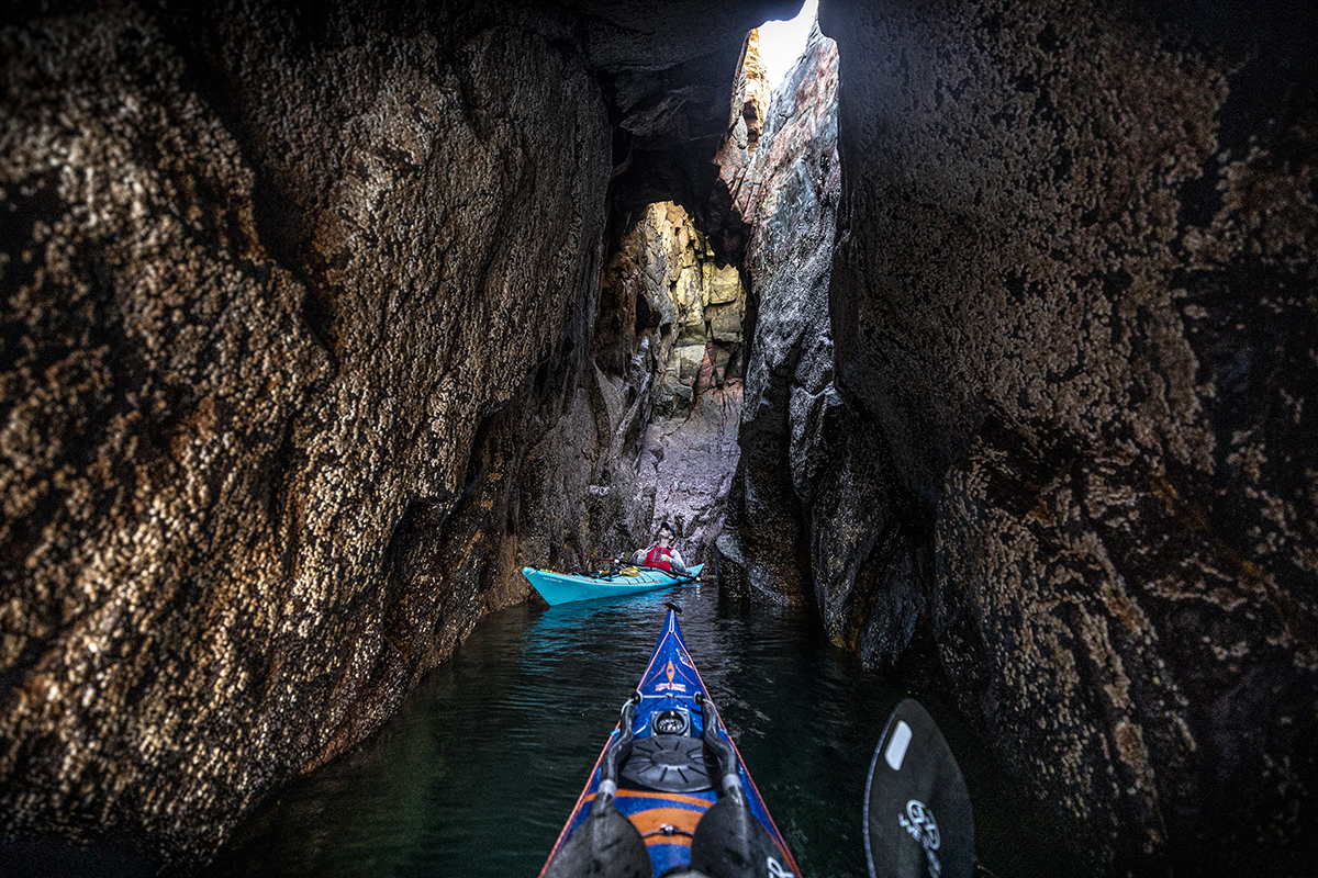
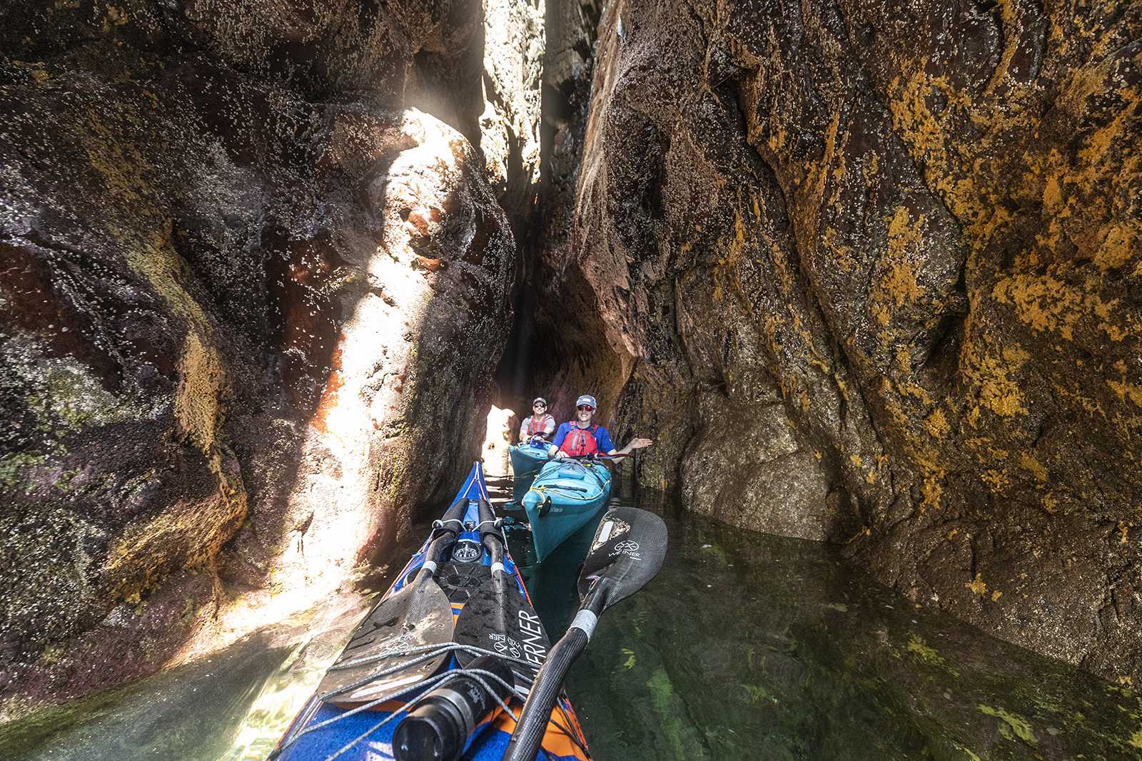
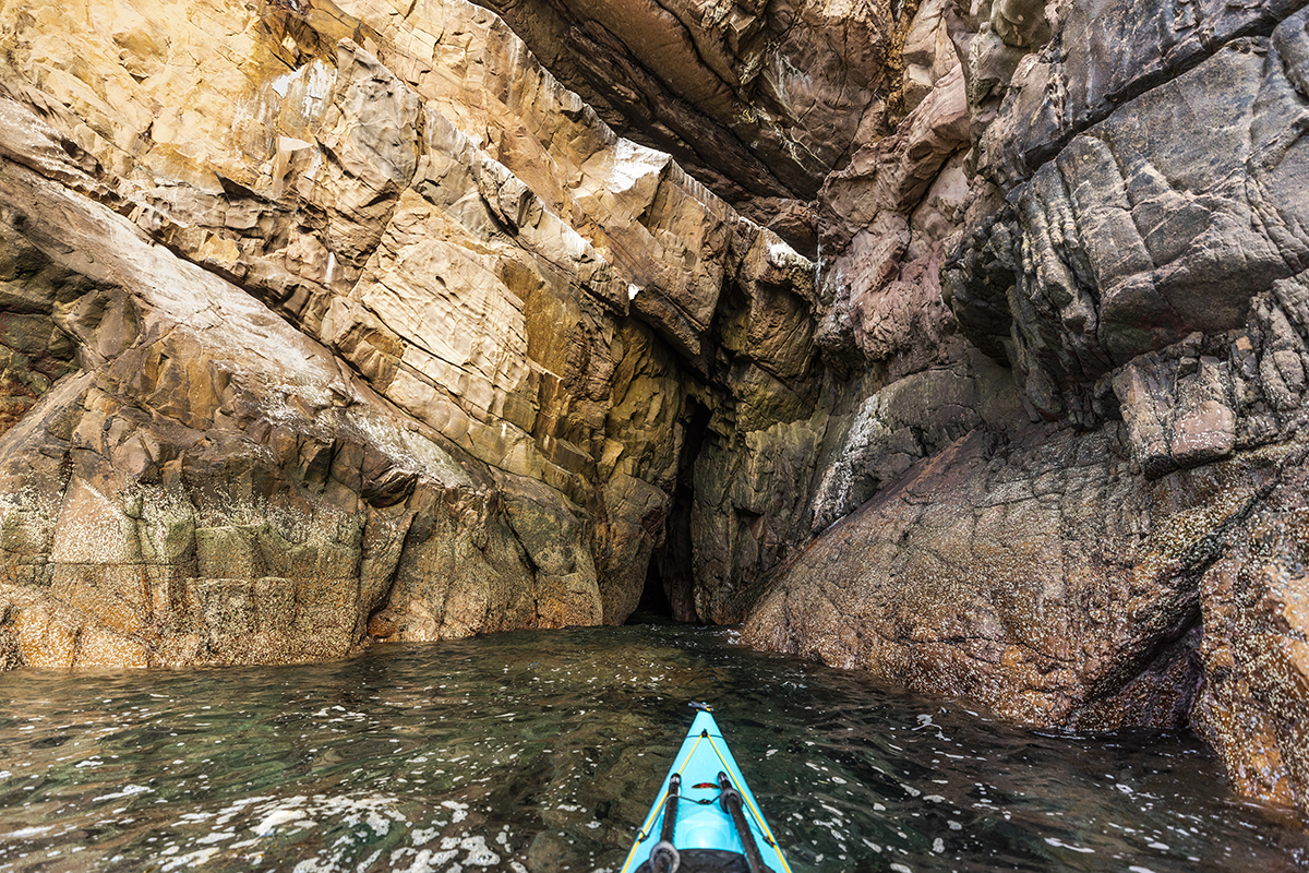
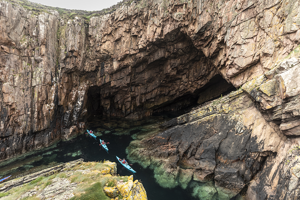
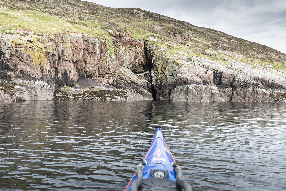
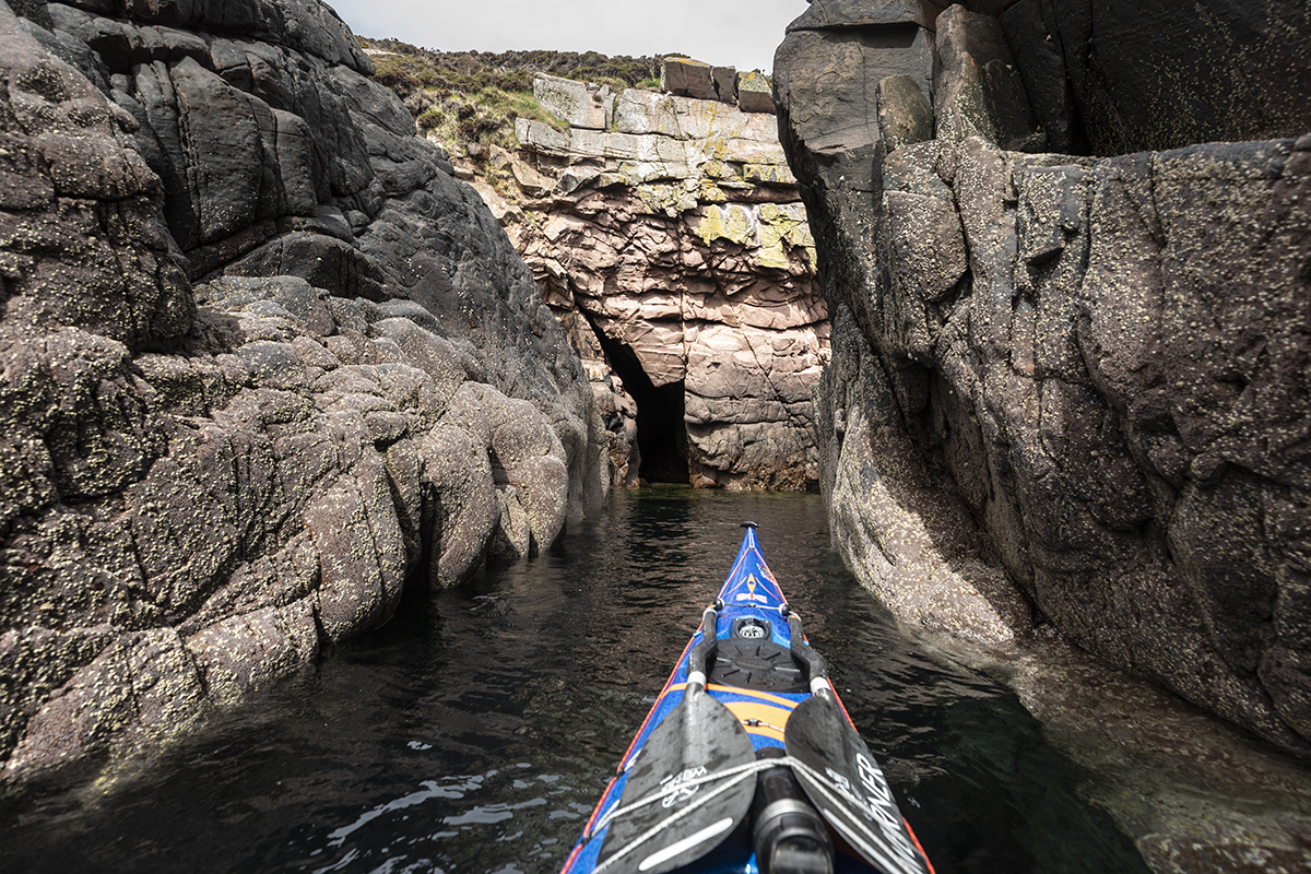
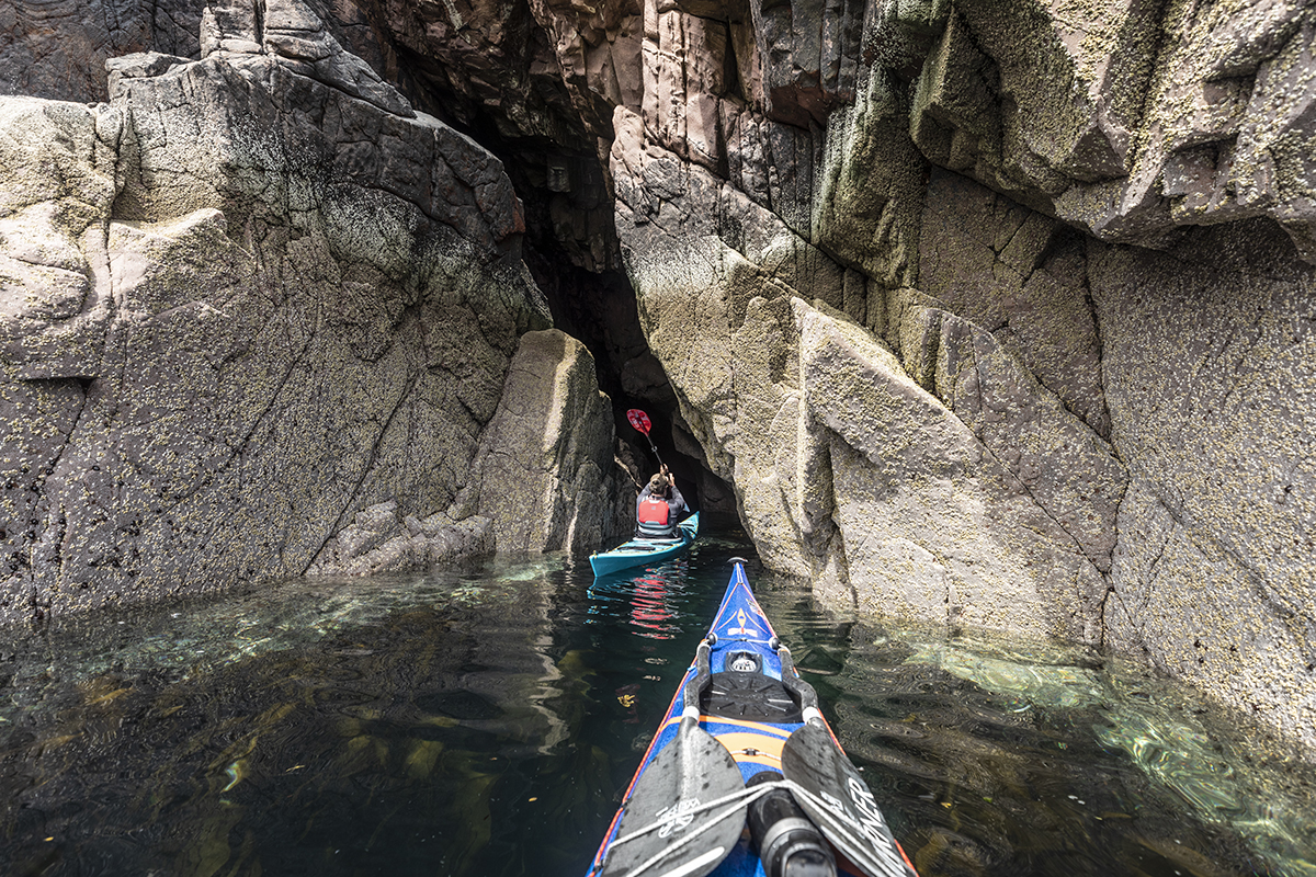
Caves, Archways & Geos
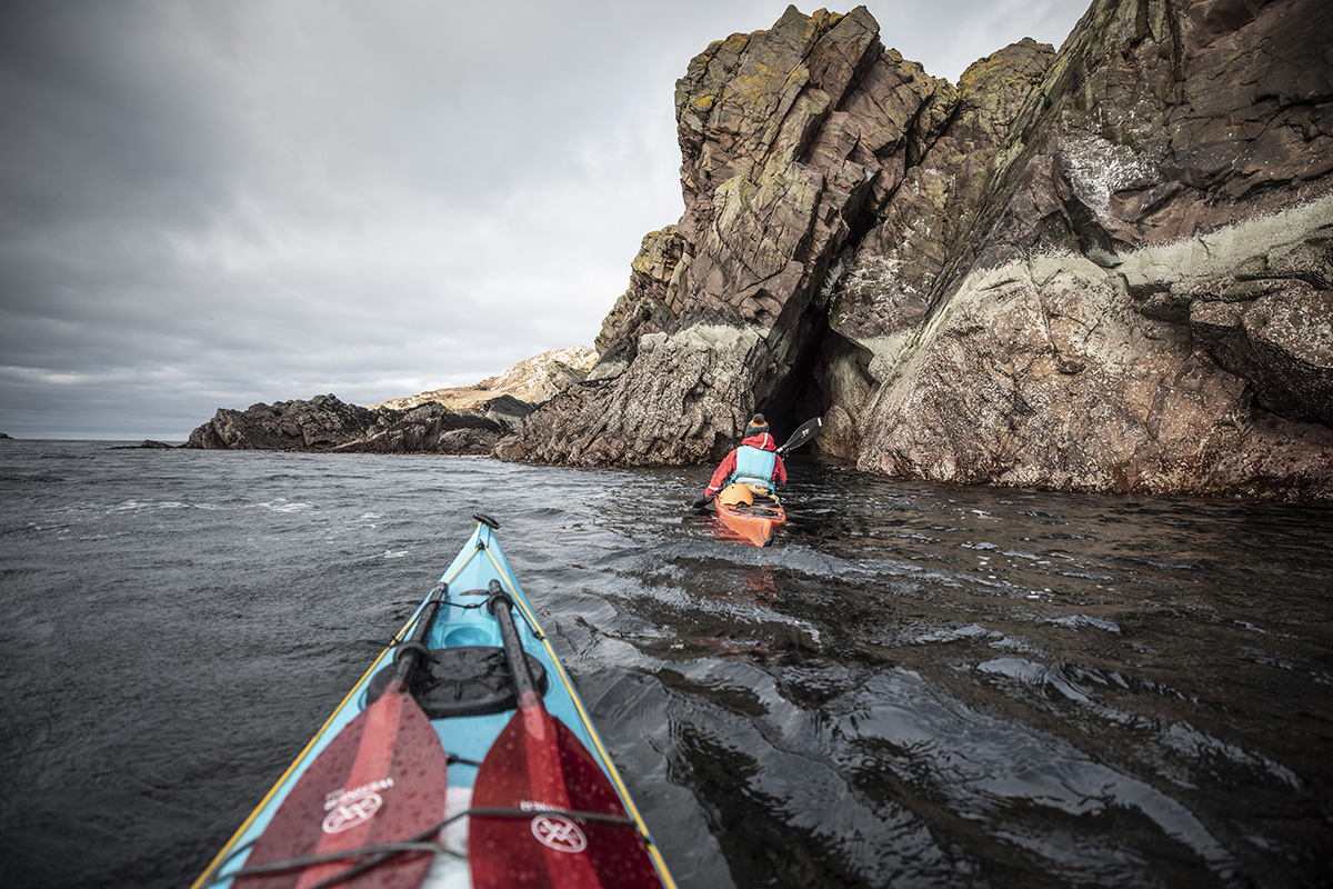
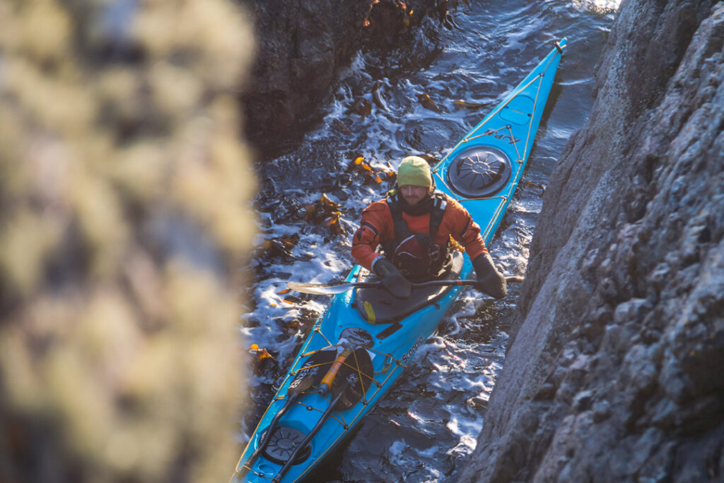
Collected over hundreds of adventures both personally and leading with Kayak Summer Isles, this is an extremely comprehensive overview of basically anything you can nose a sea kayak into across the Summer Isles. I like to think its pretty thorough but if you do spot something i’ve missed or forgotten about, I’d love for you to let me know so this guide can be improved. I’ve not included any of the many features on the mainland peninsula, which will follow on at a later date with a separate guide. If you had a great day out, tag us on #SummerIslesSeaCaves or #KayakSummerIsles on social media to share your experiences with us.
It is impossible to complete all these caves in a single day, so I’ve added a colloquial scale to help in trip planning. Of course, this is all based on my own personal perspective, so please do take this guide with a pinch of (sea) salt.
As always we encourage you to plan and prepare your own trip with due care and attention to the weather and conditions to match your ability. If you would like to join us on a guided tour please enquire here.
Cave Quality
* = Visible from the sea/only ever possible to nose bow under, not possible to paddle fully under or through.
** = Paddle-able curiosity explorable in passing
*** = Paddle-able and interesting feature worth pausing for in passing
**** = Paddle-able and impressive feature worth actively seeking in appropriate conditions
***** = Paddle-able and iconic feature of outstanding beauty or interest, worth actively seeking in appropriate conditions.
Optimum Tidal States
HWsp = Best at High water springs only (Standard port Ullapool)
LWsp = Best at low water springs only (Standard port Ullapool)
MWsp = Best at mid spring tide only (Standard port Ullapool)
AT = Good at all tidal states
Additional Requirements
☆ = Head-torch recommended to fully explore.
Guide Map

Isle Ristol
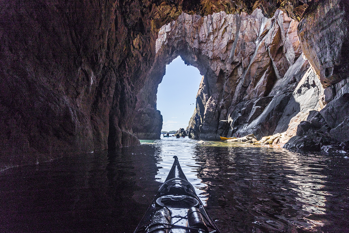
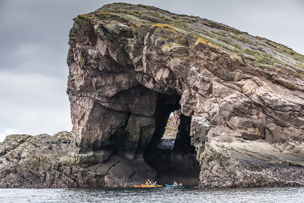
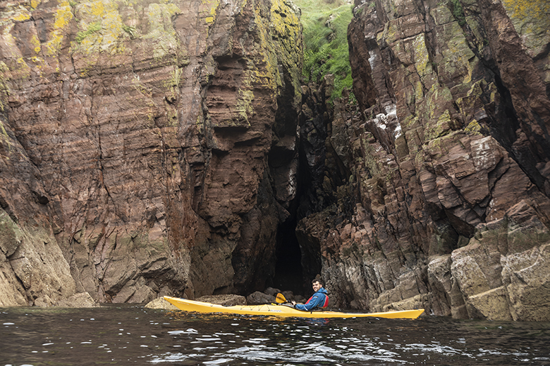
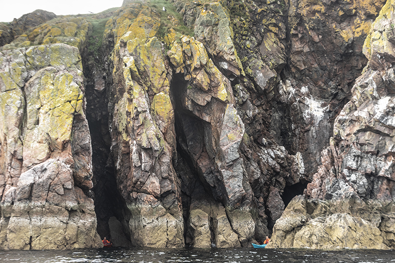
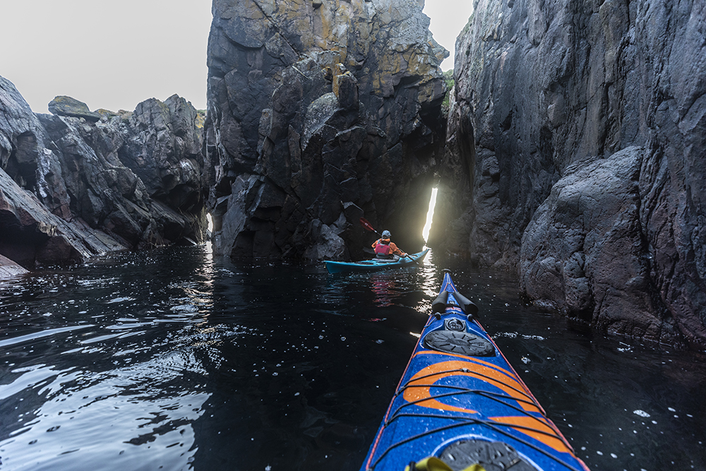
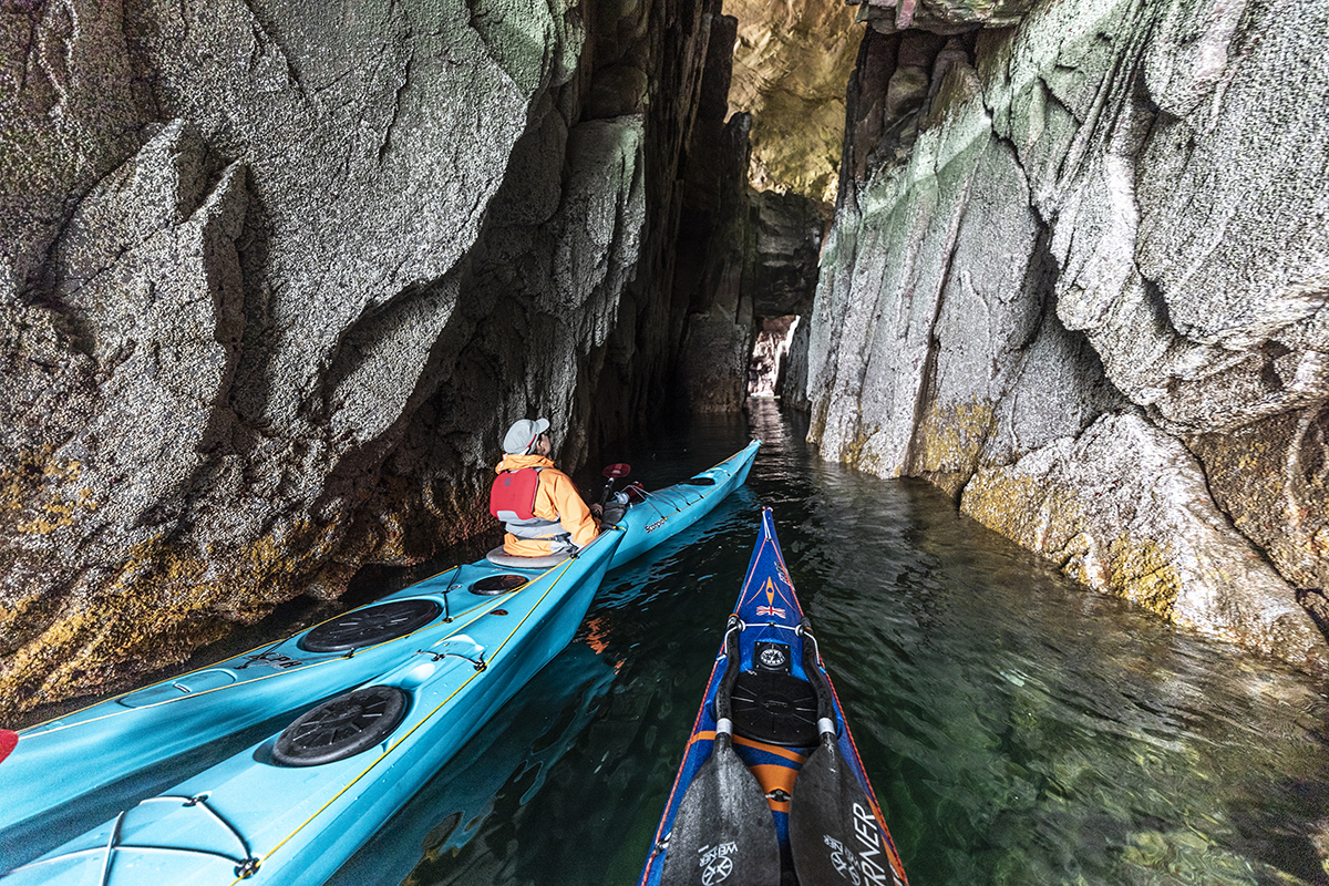
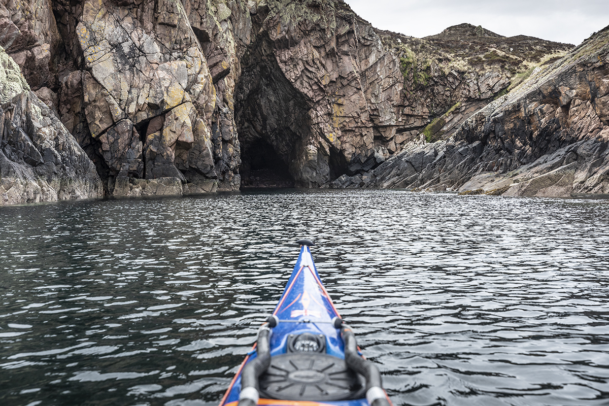
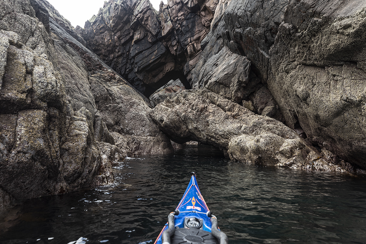
1. North Cave 1
*****☆AT
The first of a series of three cave/overhangs with some interesting channels to explore in between. The eastern most cave is the deepest and will need a head-torch to reach the back after entering through a narrow dog-legged entrance. The entire tunnel is approximately 40m long and ends a bouldery beach, often home to a resident seal. These caves are susceptible to exposure from north and westerly ocean swell and are significantly more challenging to access from the entrance when this is present, large swell may also make this cave dangerous to enter.

1.1 North Cave 2
*****☆HwSp (>4.7m)
Heading around the corner from the first north cave, we arrive at a narrow crack leading to a grand internal amphitheatre. This cave is illusive, requiring a spring tide > 4.7m in order to access the narrow, shallow entrance. If any swell is present this cave would then become dangerous to enter. The narrow entrance approx 5m then widens into an internal grand chamber, here a head-torch is required. At the rear the cave splits east and west in narrow cracks to shingle beaches not recommended to approach unless utterly calm. Look up, the height of this cave is something to behold. These caves are susceptible to exposure from north and westerly ocean swell and are significantly more challenging to access from the entrance when this is present, large swell may also make this cave dangerous to enter.
2. West Geo
****☆AT
This stands out to the eye in passing as an impressive bite from the Ristol cliffs. The geo is an impressive paddle inside. At first glance the geo appears to be a dead end, with a few small splits. However to the north east corner at the very rear there hides an impressive cave. Approximately 30m deep and dog-legged away from the main entrance. Well worth an explore in good conditions.

3. S0uth Spring Double Arch
***LWsp
A feature found only at low sping tides, this is a small double archway located on the Southern side of Isle Ristol. If you can see Laminaria kelp on the surface then this arch will be discoverable. It is easily missed amidst the many rocks of Ristol’s southern shore but well worth a look if you can find it. It is possible to paddle through it, but only at the exact perfect state of tide, even so this requires some serious limbo skills or a new scratch in your boat. It can be fun however to duck under the first arch into the zone before the second, and return back out the same entrance.
Eilean Mullagrach
4. North East Split
*MWsp
Less than 50m south of the access ladder bolted to the island there is a small split crack in the rock. This deep split is often the first feature visible after crossing from Ristol and is just deep enough to squeeze a full sea kayak inside. This crack narrows exponentially and is dangerous to enter unless with absolute zero swell.
5. North East Cave
*HWsp
Visible from a distance, this short but enticing cave can be paddled inside at the upper end of a big spring tide. It is deep enough to enter into shadow but not much further. On extreme wet days, there may be a trickling waterfall across the entrance. More fun can be had navigating the various channels and stacks which surround this cave, both to the north and south.
*Caution point: The rock overhanging the entrance of this cave appears to have become loose, at some point it will fall. There has also been some notable rockfall inside this cave in more recent years.

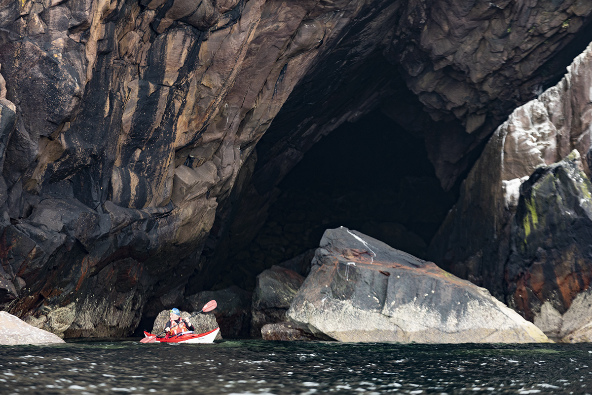
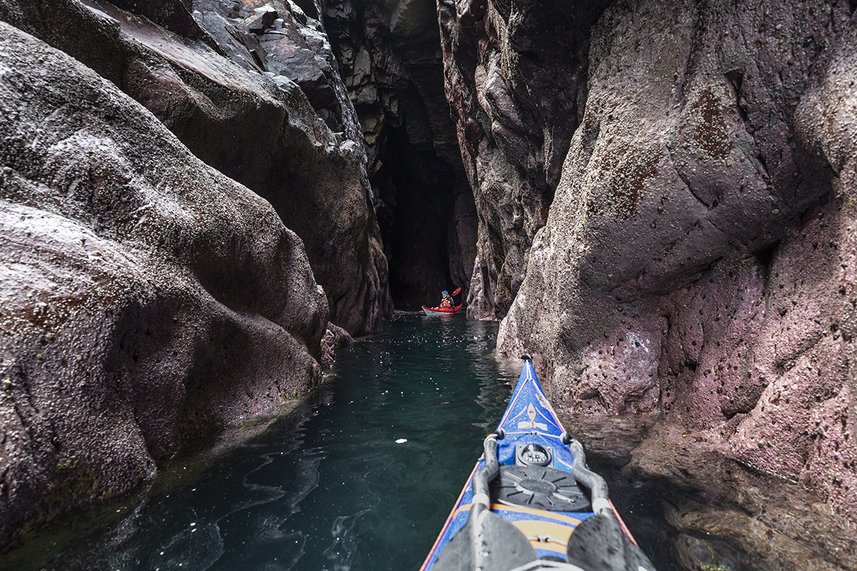
6. Am Fang Cave
*****☆AT
Deep and Iconic. The entrance to this cave is often surprisingly accessible even in larger swells, however to enter in its entirety requires calmer conditions. NNW swells tend to limit options, whereas other directions will be sheltered.
At the main entrance a large finger like pinnacle is present, which appears on lower tide, this pinnacle is a good marker. It it over 1m the tide will be too low to explore to the extremities of the cave as a rock inside blocks the way at this tide state.
The east entrance of the cave leads approximately 30-40 metres in a dog leg into darkness. 10m past the pinnacle the cave widens, at upper third of the tide this enough to allow the skilled turning of a kayak <5m. For most of the time we recommend entering in reverse from the entrance pinnacle. Beyond this a boulder surfaces at low tide blocking the way, but submerges above mid tide. 20m further back a steep storm beach of rounded boulders ends the cave. Be alert as occasionally a grey seal may be resting here, which may give you a mighty good fright. It is an unproven theory of ours, that if the stones were removed, this cave may link with the Mullagrach grand arch.
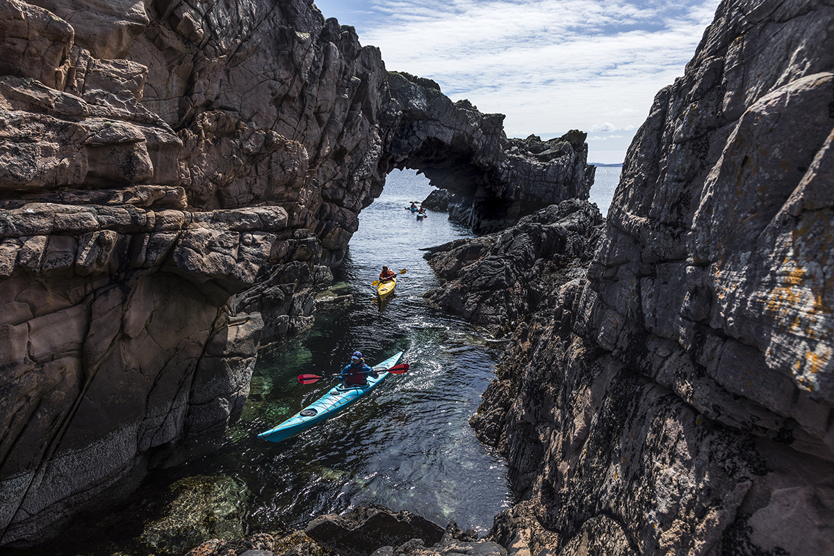
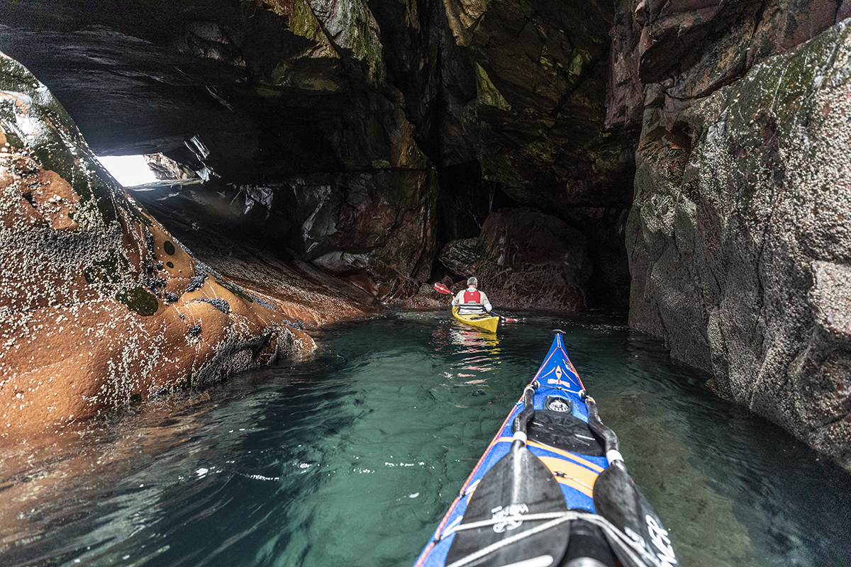
7. Mullagrach Grand Arch
*****MWsp>HWsp
An amazing feature, well worth exploring. To make the most of this arch time your arrival for mid>upper tidal height. At low tide the channel under the arch will be dry and impassable. The main arch is a tall sandstone feature approximately 20m high. The north side of the arch connects to a large cave with a stony beach at the back (possibly connected to Am Fang if anyone fancies digging through). In the side of this cave is a second, metre wide arch leading into the Mullagrach/Ristol channel which is paddle-able for about 30 minutes each tide, with a duck and a scrape.
Caution points: Be aware when passing under this archway, I have seen thrice that seabirds dislodge small rocks from above, which may pose a genuine risk to an unlucky paddler without a helmet. Make sure you have carefully checked whether there are birds resting above before passing through unaware, if in doubt do not enter or linger under the arch. With NNW or Southern swell, a large rock at the NE entrance can make a breaking wave but is passable either side with good rock hopping skill.
8. Western Geo / Cave
***☆AT
On the western side of Mullagrach lies a deep geo. Inside there is a small cave approximately 20m deep, which requires head-torch to access the deepest recesses inside. This feature is rarer to access due to the usual western swell In moderate conditions it is a lively adventure with due caution.
Tanera Beag
9. The Tanera Beag Arch
***** MWsp>HWsp
The Summer Isles most iconic archway. This one is a firm favourite for paddlers and makes a superb goal point for a days exploration. Best paddled as close to high tide as possible, where-upon a narrow channel can be navigated all the way through the arch and round the peninsula. At all other tide states, an in and out journey can be made. Southern or eastern winds makes this harder, but in all other directions the arch will be sheltered. Bonus arch* At the exact right state of tide (nearing high tide) a small archway breaching west of the main arch can be slipped through with a duck and a scrape.
10. Mol Beag Micro Arch
*AT
A small archway on the western side of the Mol Beag bay. High, narrow and shallow, this arch can be paddled under but not all the way around. It is an interesting feature to nose into in calm weather but is often over-shadowed by the nearby, far more impressive eastern archway.
11. Cathedral Crack (SE)
***LWsp
Situated about 100m east of the Cathedral cave, this narrow split is approximately 15m in depth. This is a rarely accessible due to swell but an exciting cave to explore when safe to do so. At low tide, this hourglass shaped cave is vibrant magenta with Maerl corral. Most of the time, swell and wind makes this split rough, risky as a paddling choice and is best left for absolute calm days. At high tide, this cave can be an extremely narrow and constricting passage, low springs makes it wider and safer.
12. Cathedral Cave
*****AT
One of the most iconic caves in the Summer Isles and arguably one of the largest. This cave is frequented by kayakers, divers, local tour boats and even brave climbers for an impressive deep-water solo route which runs the lip of the cave. This cave is a wide hollow in the peninsula with a large plinth and archway lighting the backside. Whilst the cave is often quite turbulent inside from western and southern swells the mostly steep smooth walls make it a safe environment so long as caution is given at higher tides to the eastern side which has a small overhang. For experienced paddlers the cave makes a superb spot for rough water handling practice when a swell runs from the south or west. When it’s calm, it is an impressive spot to sit back and enjoy reverence to such a mighty feature and it’s iconic views over the west coast beyond. Legend has it sermons were given to boats from the archway mount.
13. Cathedral Crack (NW)
***AT
A narrow crack, present on the Tanera Mor southern coast between the Cathedral cave and the south eastern bay. This one is really just a feature to nose into in passing to satisfy your curiosity. The single dark crack is immediately obvious upon approach and is large enough to get your bow underneath but little further.
14. Blowhole Cave
*** MWsp>HWsp
Paddle-able in mid-high tide, this is the last feature on the south west stretch of Tanera Beag. A narrow split leads into a cave with a large skylight above. Rounded boulders under-neath tell tale to the exposure this is normally privy to in any southern winds. Once, and only once have I seen the skylight become a blowhole, from a particularly stormy and rough day aboard a boat, at the time a 3m+ rolling swell was battering the entrance, sending a fine mist through the skylight above, the whole southern coast at the time was very much something to avoid but impressive gaze upon in awe from afar.
Tanera Mor
15. Creag Ard Cave
**AT
A small over-hang, a pinch of optimism might describe as a cave. Often the first narrow feature on a typical day out in the Summer Isles crossing over from from Rubh a Mhadaidh-Ruaidh on the mainland. It is not too deep but an good introduction to narrow spaces for a days exploring ahead. Around the corner to the south is a series of 3 narrowing channels which make a fun paddling exercise to warm up skills.
15.5 Secret Smugglers cave
**** HTsp
A quirky hidden feature Tanera Mor’s coastline. This incredibly sneaky cave lies at the end of a wonderful narrow passageway winding between a pinnacle. Inside the cave is graffiti’d with a haunting ghost like figure, some sheep, a fish “Hello Steve” and “John Moore” – rumour amongst the islands new owners is it was a real smugglers cave, reality lies closer to a grand practical joke from local fishermen. None-the-less, a firm favourite with kids. I have deliberately left this one off the map to keep the mystery of the cave alive.
16. Earbull Dhuin Crack
*MWsp
A small crevice visible from afar in the rocks on the southern shore of Tanera Mor. Possible to paddle inside as deep as the cockpit on a calm sea. Only really included so Tanera can claim a ‘cave’, if i’m totally honest.
Horse Island
17. SE Cave
***HWSp
A deep and interesting split, situated on the South Eastern corner of the island. At high tide the cave is deep and exciting to explore. It dries out with large boulders below mid tide.
18. Horse Island Arch
**HWSp
A spectacular natural archway, with a narrow entrance and high walls. Visible from all tides but paddle able only at absolute extreme spring tides, which even then with south winds or swell this will become virtually impassable. Practically easier to get out and portage through if you’re really set on achieving this one.

19. The Horse ‘Squeeze’
****☆HWSp
An extremely narrow entranced cave, barely wider than a kayak width. Starts to become accessible above upper mid spring tide. Once beyond the entrance it widens a little and deepens into a dark crevice. It is often filled with resident rock doves and is one of the deeper features of the island. Not worth scraping your boat for in any southern fetch or swell.
20. Diagonal Crack
**☆LWSp
A short distance west of the ‘squeeze cave’, this one puts narrow to the limit and is borderline potholing and you’ll want a helmet. Hands are required and ducking low at an uncomfortable left hand lean (forward entering) allows a shimmy inside. This cave ventures surprising deep and requires a head-torch to fully enter. It continues narrowing beyond the scope of a kayak and sense. Needless to say, a zero wave option only.
21. NW Bay Cave
**HWSp
A tall but short cave with a dog legged entrance, short but sweet. Fully accessible only on higher tidal states.
22. Acairseid Eòin
****AT (Western two) HWSp (eastern)
A mighty set of three vertical cracks, these caves dominate the cliffs on the west coast of Horse island. The western most is the widest and arguably most impressive to venture within, the middle is thin but enterable (just) and the right is a dog legged crack which can be fully accessed only at higher tides. A good place to feel small beneath a big landscape.
Skerries – Sgeir Ribhinn

23. The ‘Wee’ Arch
*MWsp
Best at Mid springs, (photo in upper 3rd spring tide). A narrow, one kayak wide, channel leads a tiny arch. Nothing too spectacular but an interesting feature to nose at.
24. The ‘Big’ Arch
****LWsp
Impressive, but easily missed. At low spring tide, a gap will appear beneath a large chock stone. If Laminaria kelp is visible, it should go. Unless an extreme spring, you will need to duck inside to enter, however it quickly opens into a huge hidden amphitheatre. The hidden room of Ribhinn is as exciting as it is unexpected, with a double archway and a purple glow from the Maerl coral coating the walls. Any fetch present from the east may make access difficult and swell from any direction may negate safe entry too.
Skerries – Skeir Nam Mult

25. Eastern Spring Cave
***MWsp>HWsp
A small cave at the end of a narrow entrance. Found on the north side of the archipelago on the eastern most island. It is best entered if the main channel between the islands is above water, but enterable at all states. At the rear a beam of sub-sea light is visible, and might make an incredible snorkel for those inclined to get wet.
Eilean Dubh
26. Collapsed Cave
**HWsp
Possible to paddle inside on a high spring. This once larger cave is obstructed with the remains of its roof which presumably collapsed an eternity ago. At high tide it’s fun to weave inside between the boulders and get under the over-hanging roof, which thankfully looks stable.
27. Pinnacle Cave
***MWsp>HWsp
A small crack cave, tucked neatly behind a pinnacled entrance. Easily done in calm conditions the channels behind the pinnacle become a lively explore in rougher water or big swells. The cave itself is a deep, constricting crack . The approach is arguably the most exciting stage, sneaking around a large pinnacle with a narrow channel, behind the pinnacle is often sheltered from wind but amplifies swell significantly. The cave dries at low springs, but the channels before it are paddle-able at all tides.
28. The Beach Cave
*>HWsp
This cave is large, wide and only accessible by kayak on an extreme storm spring tide. However, if arriving to the islands in the pouring rain and looking for a pause it makes a nice sheltered spot to land, although landing below mid tide is a challenge. Inside, a fantastic view is presented to the western coast beyond.
29. Southern Cave
***LWsp>MWsp
Close to the southern most tip of the island. This cave is one of the deeper features of Eilean Dubh and is an interesting nose inside. This feature exists to varying depths in all tide states. At low tide a head-torch is recommended to see all the subsea features on the walls.
Carn Iar & Carn Deas
30. Robin’s Sound Cave
**AT
A small hole in the eastern crags of Carn Deas best paddled in high neaps or mid-springs. The shallow sandy sound is known to the Lochbroom Sailing club as ‘Robin’s sound’ in memory of Robin Cambell, who was fond of mooring there over the years.
30.1 Sgeirean Glasa “Love Arch”
****AT
A wonderful archway on the southern tip of the Sgeirean Glasa islands. Occasionally has been used for romantic couples to pose underneath after proposals on the local tour boat. A romantic, love heart shaped archway.
31. North Caves (Carn Iar)
**MWsp
A series of two caves just north west of the tombolo beach between the Carns. There is a large diagonal cave on the south of the bay and a small deep cave to the west edge. The large cave paddles best at higher tidal states, the smaller is better at mid-tide.
32. Western Geo (Carn Iar)
**AT
More of an overhung geo than a cave per-se but none-the-less an impressive feature to nosy into en route past Carn Iar. Often makes a nice little shelter to pause from the weather if the wind is blowing from the south or the north. The geo is exposed and rough to enter with any western orientated swell. The overhanging rock allows light to pass underneath giving a glowing ‘green room’ like appearance inside, especially toward the bottom ends of the tide.
Bottle Island

33. South Eastern Double Split
**HWsp
Two small crack caves on the very south eastern side of the island. Immediately spotted upon rounding the cardinal corner if paddling from the eastern side. Both caves are possible to pass a kayak inside, but are narrow and subject to become impassable in fetch or swell.
34. The Bottle Double Archway
*****HWsp
Possibly the finest hidden gem of the Summer Isles. This is a double archway with a short narrow cave at the rear. Finding the archway on the southern side of Bottle Island isn’t too difficult as the tall archway rears up over a deep geo. From afar it appears to be a dead end, but inside there be secrets to be found. It is possible to enter forward under the arch and carefully turn around to a second much thinner crack in most kayaks, (Kayaks >17ft may struggle). The split west of the arch is narrow and smooth sided but plenty of barnacles to scrape a boat if contacted, with skill is possible to paddle through with a run up and a stern rudder or with good edge control. More often it requires pushing through with hands either side. With any swell from the South / SW or larger northern swells it is not advisable to attempt this second passage. To make it through the narrow western split, the tide must be high neaps or mid springs to pass, BEWARE a narrow constriction if on low – mid tides which if dropped into by a wave will trap and may severely damage a glass kayak.
35. South Central Split
** MWsp>HWsp
A narrow cave a little longer than a kayak. Worth exploring if you like nosing into every crack and crevice for the sake of it. In breeding bird season, this cave should be avoided to minimise disturbance to the resident shags and cormorants.

36. South West Cave
***AT
A narrow split in appearance, this western crack in the Bottle Island cliffs leads to a fairly deep cave, approximately 20m long. A calm weather exploration option, it offers a lovely green glow as the light penetrates the water from the overhanging entrance. The higher the tide the narrower the passage, but it remains paddle-able in all tidal ranges. A good alternative if the tide is too low for the south east arch.

37. Western Geo
***AT
Rarely paddle-able safely and requires little to zero western swell. This is a long geo turning into a narrow cave. The channel weaves multiple times before leading to a widening (not enough to turn). If flat calm it’s well worth venturing inside.
Priest Island
38. The Elephant Arch
**MWsp>HWsp
Bearing an uncanny resemblance to an Elephant with its trunk outstretched as if drinking from the sea, this small archway lies on the first beach to the south east side of Priest. Paddle-able at a squeeze at the right state of tide, it is a novel feature that makes a fun detour in passing.
39. Grand Geo
****AT
A narrow entrance leading to a tremendous overhung geo. One of the more impressive geos on priest. To the right side upon entering leads to the chockstone cave (40). This is a very impressive and worth exploring feature. Reliably sheltered in all conditions. Caution note – cliff appears relatively unstable – be aware of rock hazards.
40. Chockstone Cave
****MWsp
At the southern end of Aird Glas Geo (also well worth exploring), is a narrow cave accessed from beneath a chock stone.
Paddle-able with mid springs, high tide prevents access beneath the chockstone and low tide dries up the entrance. A point of interest is the visible fossilised rippled sand present at the entrance a 1 billion year old legacy of the Torridonian sandstones desert past. At the eastern end is a razorbill colony and is best avoided during breeding season.
41. NE Bay Cave
**HWsp
A small short cave. Interesting to nose inside whilst weaving through the many channels on Priests eastern shoreline. Can make a fun venue for rough water handling if a north swell is present.
42. Triple Cave
** HWsp
At the rear of a narrow entrance, which often over-pours with western swell. A series of three short caves are present. None of these caves are particularly deep, however the tall crags around the entrance are certainly impressive.
43. Grand East Cave
****☆AT
The deeper of the series of caves, along the east shore of Priest. A short way further north than triple caves with a similar narrow channel to enter. This cave is reliably sheltered and well worth the additional paddle inside to explore. Wide and grand it is reminiscent of the caves on the north coast of the Coigach peninsula.
*Note of interest – for the last four years (2018>present) a reflective fishing buoy jammed into the beach at the rear will reflect from your head-torch a white X.
44. Shallow NE Cave
***HWsp
Continuing north along the eastern coast find this shallow double cave. It is only enterable at high water and comparatively less interesting than those you’ll have explored so far.
45. Hidden Archway
**HWsp
One to tick if hell bent on exploring every nook and cranny of Priest, otherwise avoidable. This is a small archway tucked at the back of a narrow geo. There is a nice beach at the back, but beware that a chock stone will appear on a falling tide at the entrance of the geo, making exit from this arch a laborious portage if caught out.
46. Skylight Cave
****☆ LWsp
This is a deep cave with a skylight above the entrance. At low tide, it becomes a very deep cave. With any northerly variant of swell, a gut wrenching boom rumbles inside, be cautious this cave is a boat eater in these conditions and it’s best to stop at the skylight.
If calm enough to continue a head-torch is needed. Inside the smooth walled cave ducks under a rounded lip and widens, continuing into darkness around a dog leg around 25m, from here it constricts impassibly into the abyss. It’s rare to enter fully, but darn impressive if you can.
47 . The Grand Priest Arch
***** HWsp
Without doubt the most impressive arch in the Summer Isles. It’s framing of the Inverpollaidh and Assynt mountains this arch is iconic and it’s high enough i’ve even entered the first part of this arch in a sailing boat. Bisecting the islands Northern peninsula (Toll Eilean a’ Chleirich) the hole can be seen from as far as Tanera Mor, some 6km away, like the eye of a needle.
The arch is fully paddle-able at the upper third of spring tide and when considering Priest this is the one you want to base your tidal planning for. As a bonus this also allows you to avoid the moderate tide race (>2knots in springs) on the headland outside the cave. The arch’s entrance is deep and allows entry in all but the most extreme swells, however the narrow neck of the arch grows shallow. Particularly in N or W swell directions this narrows can be extremely rough, especially in west swell where it wraps either side of the headland and meets in the middle, i’ve seen it hit the roof in this state! Either side of the narrows is a safe place to re-convene, but be sure to scout the south eastern entrance side if in doubt as larger swell will break over the rocky outcrop sheltering the cave here. Another caution note: at the north end of the narrows is a large submerged (and drying boulder), which is renowned for creating sporadic breaking surf, seemingly from nowhere, if a larger set of waves roll in, good observation is advised.
48. Low tide arch & Cave
***LWsp
Perhaps an alternative if the grand arch is dry. This is an arch leading to a cave beyond a weaving path of bouldery channels. Directly west of the Grand Arch and in the final inlet before the north tip it is paddle-able at a low spring. Duck under the low arch and paddle through a labyrinth of rocks to reach a tall but shallow cave. Zero swell required, and probably a helmet in most conditions, be careful not to get caught out by rising tide, the window of access time is narrow!
49. West Geo Cave
****AT
A tremendous geo constricting into a deep cave. Nestled between some of the taller cliffs of Priests western shore, this is one of the finer features of the island. A wide and grand geo soon narrows into a constricting, but tall cave. This can be paddled at all tides. It is sheltered from all but the more extreme fetch, however conditions with any western or north western swell can be lively and challenging in this feature.
50.The Window Cave
****AT
Debatably one of the most exciting caves on Priest, yet also extremely easy to miss. Found at the back of a narrow geo directly around the south western corner of the island. In calm conditions this is a deep cave with a window to the west, if you were inclined to land (challenging) amongst the large boulders, it would be possible to walk through to the west side of the island via a tremendous archway channeling a significant distance right through the headland. Western and Southerly swell make entering risky, but if a big north swell is present the sea explodes through the window, soaking paddlers inside, it’s like being in a colossal, indimidating power shower.
51. Southern Splits
***AT
A series of three shallow crack caves on the southern side of Priest. These are best avoided during the breeding bird season as around the entrance a large Razorbill and Guillemot colony resides.
52. South Eastern Splits
**AT
Just after rounding back to the east there are two narrow crack caves. Deep enough to enter but not go much further inside. A couple of these perhaps pose interesting exploration to a more nimble cave diver, but beyond that, to us it remains unknown so far.
53. Eastern Crack
**AT
A lone crack along the south eastern slabs. Best avoided in breeding bird season due to nesting Razorbills. Inside this crack leads approximately 8m, and perhaps significantly further if you got out and started cave swimming.
54. Hidden Cave
*HWsp
This one is enjoyable more for the short adventure it takes to access it rather than the cave itself. The cave is approximately 5m deep and juuuust enterable with a push, however finding it leads you through a hidden labyrinth of kayak width channels running perpendicular to the coast. If east winds are present this is also a welcome avoidance to any clapotis. Only paddle-able at higher tides.
55. North Eastern Cave
**LWsp
North of the perpendicular channels, a final crack presents itself. Approximately 10m deep, it is possible to enter a kayak well inside with a push and a scrape. Again, a bold caver may venture further than a kayak might.
Carn nan Sgeir
56. South Geo
*AT
Marginally describable as a cave, but a nice feature on the island and worth a nose inside while passing.
Isle Martin

57. The HW South ‘Arch’
*>>HWsp
One of two ‘high and dry’ archways on the island, more a visible curiosity than a paddle-able excitement. On the southern shore of Isle Martin and visible best at a high tide.
58. The Smugglers cave
***☆ AT
Above the tidal zone but this cave gets a mention solely because it’s quite an interesting curiosity to land and wander inside. On the south western cliffs of the island there is a deep and obvious hole at the base of the cliffs. On a mid-low tide landing can be made easily to the east and a short scramble leads to the cave. Inside the cave goes back 30m+ into darkness. A few scattered relics of ancient fishing equipment can be found in the mud and bat droppings litter the floor. Watch your head on the way out as an overhang has a habit of kissing foreheads.
Be extremely cautious in approach as this section of coastal cliff can be fairly unstable and areas have collapsed as recently as 2021.
59. The one paddle-able ‘cave’
*LWsp
Hidden behind a large block on the north eastern side of the island. This feature can be tucked inside approximately 5m. Only paddle-able at low spring tides, it is as interesting to get a clear look at the many deep see urchins, anemones and starfish beneath as it is for its darkness above. This can be a great spot to find ‘dead mans fingers’ sea sponges.
60. Second Arch
*>>HWsp
Opposite the fish farm, and below the small tin shed to the east of the main buildings on Isle Martin. A small archway sits high and dry on the shore. It’s possible to paddle up to it and look through, but you wont get a kayak under it.